Geo-Tagged Photography with Unique Verification System
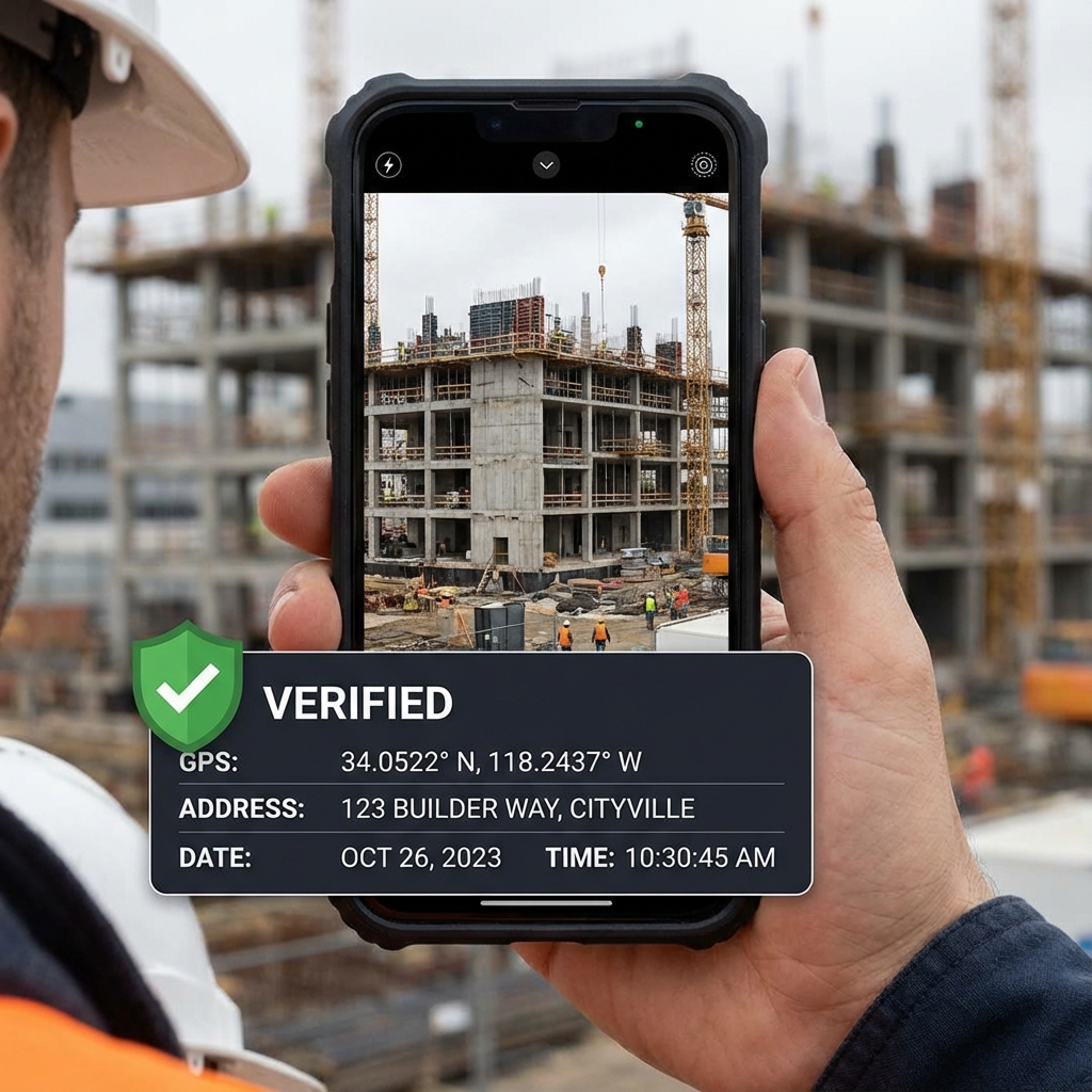
GeoGPS Camera ensures photo authenticity with unique verification IDs, anti-tampering protection, and 100% genuineness reports for professional documentation.
In an era where photo manipulation is trivial, how can you prove a photo was genuinely captured at a specific location and time? GeoGPS Camera solves this with a unique verification ID system and anti-tampering technology.
The Problem: Photo Authenticity
Traditional geo-tagged images can be edited, photoshopped, recompressed, or falsely reused with incorrect locations. There's no reliable way to prove that a photo was genuinely captured at a specific place and time - until now.
Geo-Tagged Photography
Capture photos with location details, date & time, and address information embedded at the bottom of the image. Crucially, the location and time data cannot be edited or altered, ensuring authenticity.
Unique Verification ID System
Every photo gets a unique verification ID generated via the geo-tagged visual page. Each ID is linked to one original photo, creating an immutable record of the capture.
Verification Process
The verification process is straightforward: capture a photo in the app, generate a verification ID, visit the verification website, enter the verification ID, upload the image (or PDF), and the system validates the ID existence, image authenticity, and match with the original capture.
100% Genuine Report
If the uploaded image matches the original with no modification or compression, the result shows "100% Genuine." If the image has been edited, compressed, or manipulated in any way, verification fails. This provides irrefutable proof of authenticity.
PDF Export for Integrity Protection
To prevent compression or image alteration, you can export photos as PDFs. PDF format preserves original image integrity better than image formats that might be automatically compressed by messaging apps or cloud services. Upload the verification ID with the PDF file for authenticity validation.
Advanced Camera Controls
The app provides professional camera controls: flash control, zoom in/out, light enhancement, aspect ratio selection, grid overlay, and level indicator for straight captures. These features ensure high-quality documentation.
Map Customization
Change map type (satellite/standard), adjust zoom level, choose default mode (camera/verification), and customize capture mode. The map integration provides visual context for location verification.
Address Display Control
Customize the address display format in the geo-tag. You can manually edit the address text only - geolocation coordinates and time remain locked and uneditable, ensuring the core authenticity data is protected.
Anti-Tampering Design
Location and time are locked and cannot be edited. Verification fails if the image is modified, compressed, or if metadata is altered. This robust anti-tampering design makes the system reliable for legal and compliance purposes.
Offline Camera with Online Verification
Camera capture works offline, so you can document in the field without connectivity. The verification process requires internet access only when you need to validate authenticity.
Local Storage and Privacy
Photos are stored locally on your device with no forced cloud upload. Verification only occurs when you initiate it, giving you complete control over your data.
Professional Use Cases
Perfect for site progress documentation in construction, legal or compliance evidence, delivery proof for logistics, survey and inspection reports, and event verification. Any scenario requiring proof of location and time benefits from this system.
Conclusion
GeoGPS Camera provides a solution to photo authenticity that's both technically robust and easy to use. With unique verification IDs, anti-tampering protection, and PDF export for integrity, it's an essential tool for professionals who need verifiable photo documentation.